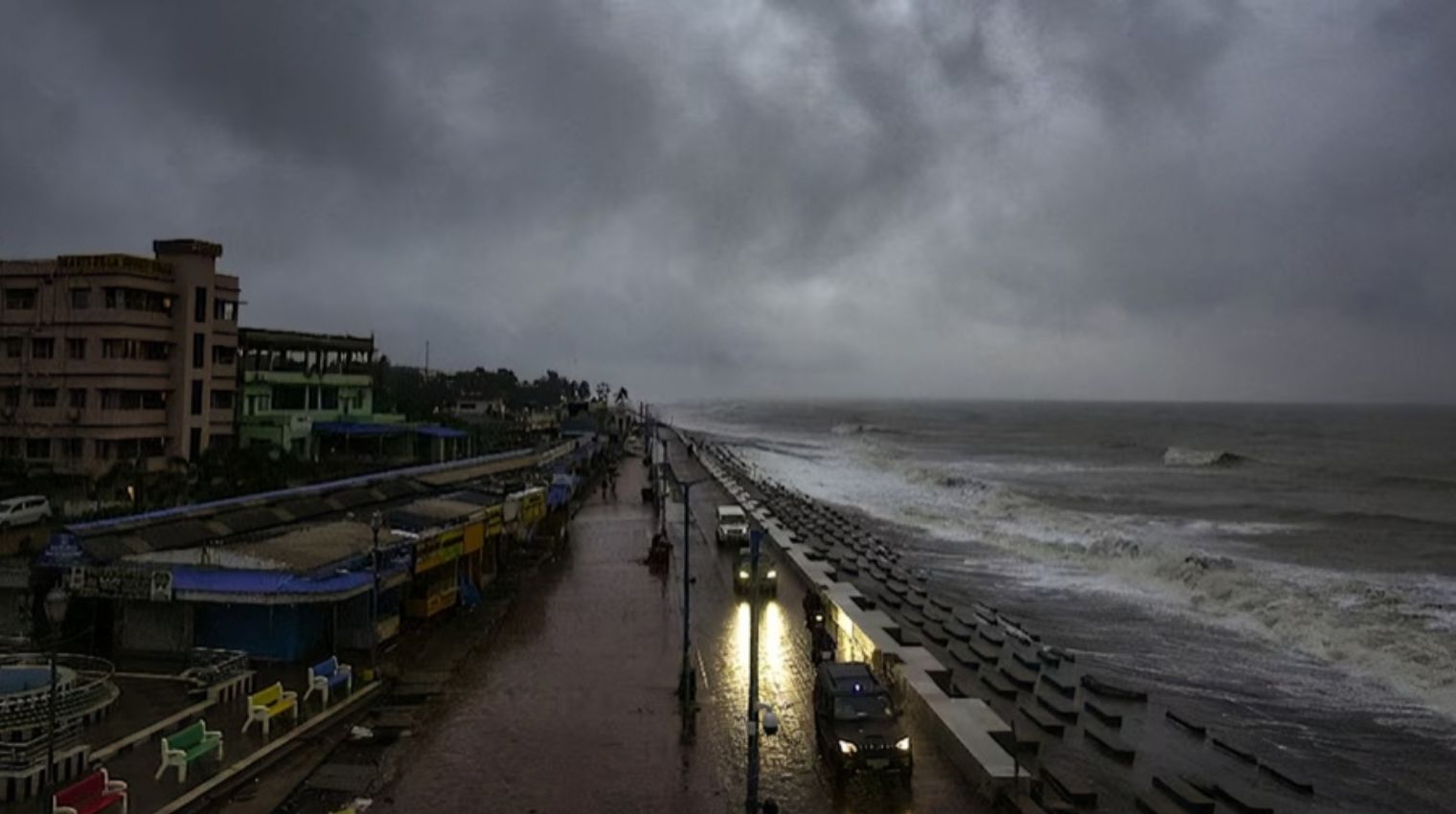
New Delhi: As’severe’ Cyclone Dana made landfall on the Odisha coast Thursday evening and into the early hours of Friday, authorities stayed vigilant. Extremely heavy rain and a sudden increase in wind speed, reaching 100 to 110 kmph, were experienced by the coastal districts of Bhadrak, Kendrapara, and Balasore. In West Bengal, comparable circumstances were also observed.
With wind speeds of about 110 kmph, the storm made landfall between Bhitarkanika in the Kendrapara district and Dhamra in Bhadrak after moving 15 kmph north-northwest over the previous six hours, according to a senior IMD officer.
As the severe cyclonic storm progressively weakens and moves further into the state on Friday, causing heavy rainfall in most areas, IMD DG Mrutunjay Mohapatra stated that the system will remain in place.
Here are the updates on Cyclone Dana:
After striking the continent with a wind speed of 110 kmph, the powerful cyclonic storm Dana has diminished and is now a cyclonic storm. The cyclone’s core was roughly 30 km northeast of Bhadrak town and 50 km north-northwest of Dhamra.
“The maximum sustained wind speed around the centre of the cyclone is about 80 kmph to 90 kmph gusting to 100 kmph,” according to the IMD.
According to the IMD, the cyclone is expected to gradually deteriorate into a deep depression over the course of the next six hours as it moves northwest across north Odisha.
In 1999, the biggest cyclone to hit Odisha in recent memory raged for 30 hours, killing 10,000 people.
The cyclone season, which runs from April to December every year, sees severe storms that cause significant damage to coastal cities in India and neighboring Bangladesh.
The Odisha Raj Bhavan is operating a 24-hour control room in anticipation of Cyclone Dana. Their phone number is 033-22001641, and their email address is [email protected].
Preparation Reduces Dana’s Impact, But Cyclones Are Getting Worse
As the world warms as a result of climate change brought on by the use of fossil fuels, scientists have warned that storms are getting stronger.
More water vapor is released from warmer ocean surfaces, giving storms more energy and bolstering winds. Additionally, storms can contain more water due to a warming atmosphere, which increases the amount of heavy rainfall.
However, the number of fatalities has significantly decreased due to improved forecasting and more efficient evacuation preparation.
What Happened In The Last 12 Hours?
As the’severe’ cyclonic storm Dana hit land on Thursday night and lasted for 8.5 hours, authorities stayed on high alert and people hunkered down.
Here is what transpired in Odisha:
- Due to intense rains and a 1.15-meter surge in sea level, trees were uprooted, electrical lines were snapped, and some regions were submerged.
- Wind gusted up to 120 kph (75 mph), with speeds ranging from 100 to 110 kph (62 to 68 mph).
- A “gale force wind” struck the Sundarbans, the world’s largest mangrove forest, uprooting hundreds of trees.
- Beachside makeshift stores were destroyed.
- There have been reports of standing paddy crop damage, primarily in nearby West Bengal.
- Parks, museums, and educational institutions were all closed on Friday.
- At 8 am, flight operations at the airports in Kolkata and Bhubaneswar restarted after being suspended. There were hundreds of trains cancelled.
- There were no reported fatalities or injuries.
Odisha Chief Minister: 1,600 Pregnant Women Gave Birth At Relief Centres
1,600 of the 4,431 pregnant women who were moved to relief centers because of Cyclone Dana have given birth, according to Odisha Chief Minister Mohan Charan Majhi.
At Niali Hospital earlier in the day, a woman who had been evacuated from the Cuttack district gave birth to a boy.
The Information and Public Relations (I&PR) section of the state government reported the birth, emphasizing that the woman was one of 4,431 pregnant women who were transported to cyclone shelters.
Upcoming: Cyclone Dana’s Impact In Bihar
In the neighboring state of Bihar, where the Indian Meteorological Department (IMD) has issued warnings for heavy rain and strong gusts, cyclonic storm Dana is demonstrating its effects after making landfall in Odisha.
More than 34 districts in Bihar had cloud cover, and temperatures dropped by one to six degrees Celsius.
Rainfall is expected across eastern, south-central, and eastern Bihar on Friday, October 25, with the districts of Kosi and Seemanchal likely to see the most intense downpours. 24 districts, including Buxar, Rohtas, Aurangabad, Gaya, Arwal, Bhojpur, Nalanda, Jehanabad, Nawada, Lakhisarai, Sheikhpura, Begusarai, Khagaria, Munger, Banka, Jamui, Saharsa, Madhepura, Purnia, Katihar, Araria, Kishanganj, Supaul, and Patna, are expected to experience rain, thunderstorms, and winds of 20 to 40 kmph.
Dana’s effects will continue on Saturday, October 26, with rain expected across northeast, north-central, and south Bihar. Authorities are cautioning locals to exercise admonish as they warn of thunderstorms, lightning, and high winds in these places.
Rains To Continue in Bengal Till Evening
The South Bengal districts will continue to see heavy rains throughout the day, with the intensity of the precipitation predicted to decrease in the evening, according to forecasts from the Regional Meteorological Office in Kolkata.
The state administration reports that coastal Sundarbans areas including Namkhana, Sagar Islands, and Patharpratima experienced the worst impact during Cyclone Dana’s landfall process, with several trees being uprooted due to strong winds. Trident lampposts also suffered significant damage, particularly those close to Sagar Island’s “Kapil Muni Ashram.”
Crucial Food Items To Raise in Price?
In West Bengal, harvestable crops—particularly paddy and potatoes—were harmed by Cyclone Dana’s intense rainfall.
Prior to the upcoming celebrations of Diwali and Kali Puja, it is anticipated that the retail marketplaces will have high prices for some basic food items.


Leave a Reply